Google Metro and tram maps of major cities in France are online - France WebWatch
by gaopengbo on 2009-01-18 17:19:43
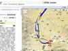
According to 2083 reports, that is, after the French Street View, Google has recently announced in the Google Earth and Maps official blog (Google LatLong: New ways to get around with the Transit Layer) provides metro and tram maps of major French cities including Paris, Lyon, Marseille, Rennes, Bordeaux and Toulouse. The update is said to use Google Transit data.