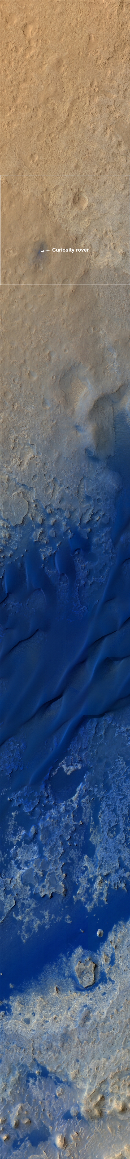
Curiosity landing site terrain panoramic color map
Researchers are analyzing the images taken by Curiosity's camera and HiRISE to lock potential targets for Curiosity. Vasavada said: "The science team and the operation team are evaluating several potential exploration routes, and Curiosity will follow one of these routes to reach Mount Sharp.
Along the way, Curiosity will study several different areas that we identified while mapping out the landing site. As previously pointed out many times, most of our first year will be spent getting Curiosity onto the stratified deposits of Mount Sharp and studying them."
Currently, Curiosity has completed a four-day transition period, during which the software on its main computer was upgraded to drive the rover forward and utilize the tools on its robotic arm. The upgraded software adds a series of functions to facilitate Curiosity's research work on the Martian surface.